Explore Software for Drones

Clear All

Data Analytics

  • PicStork AeroMegh

    PicStork AeroMegh

    AeroMegh

    Image ProcessingObject DetectionMachine Learning
    View Product

    PicStork AeroMegh

    AeroMegh

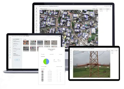
    PicStork helps automate end-to-end aerial image analytics right from capturing images to processing the data. Users of PicStork can bring their data, train detectors and analyze data, everything on their own.

  • DF Scanner

    DF Scanner

    DeepForest Technologies

    UAVDeepForestforest
    View Product

    DF Scanner

    DeepForest Technologies

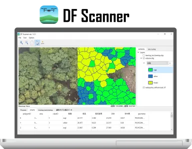
    DF Scanner is GIS software for analyzing forest information from UAV, and can identify tree species and estimate tree size at each tree level.

  • Vectorisation of 3D Pointclouds

    Vectorisation of 3D Pointclouds

    Pointly GmbH

    3D PointcloudsVector Models CAD DataSaaS Platform
    View Product

    Vectorisation of 3D Pointclouds

    Pointly GmbH

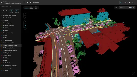
    You now have access to a comprehensive toolbox for drawing vector models in your point clouds. Easily vectorise your point clouds within Pointly’s intuitive web interface, enabling a seamless workflow and increasing the precision and efficiency of your projects.

    Make use of our intuitive toolbox to:

    - Place Points

    - Draw Polylines

    - Create Polygons

Data Processing

  • DroneNaksha AeroMegh

    DroneNaksha AeroMegh

    AeroMegh

    PhotogrammetrySurvey and MappingData Analytics
    View Product

    DroneNaksha AeroMegh

    AeroMegh

    DroneNaksha is designed with a thought of delivering one of its kind, drone survey and mapping experience. DroneNaksha is a SaaS (Software as Service) from AeroMegh platform for various photogrammetry solutions. Along with orthomosaic, DroneNaksha also generates other data types like Digital Surface Model, Digital Elevation Model, Vegetation using various photogrammetry algorithms.

  • Classification of 3D Point Clouds

    Classification of 3D Point Clouds

    Pointly GmbH

    3D Point CloudsClassificationSaaS Platform
    View Product

    Classification of 3D Point Clouds

    Pointly GmbH

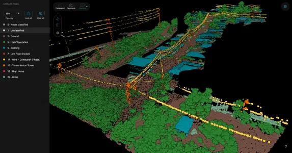
    Pointly offers efficient point cloud object classification using innovative AI techniques.
    Standard classifiers, based on deep learning, automatically categorize point clouds for common use cases like Airborne Laser Scans, City Inventories, and Highway Scans.
    Custom classifiers provide tailored solutions for unique data requirements, ensuring accurate classification.

  • DF LAT

    DF LAT

    DeepForest Technologies

    LiDARDeepForestforest
    View Product

    DF LAT

    DeepForest Technologies

    DF LAT is LiDAR Analysis Tool of UAV data, for obtaining high quality ground point and DTM/DSM

Enterprise Solutions

  • SurveyTransfer is an innovative cloud-based map and 3D data sharing platform.

    SurveyTransfer - Beyond Data Sharing

    SurveyTransfer

    GISData sharingSurveyTransfer
    View Product

    SurveyTransfer - Beyond Data Sharing

    SurveyTransfer

    SurveyTransfer is a web-based platform designed for effortless sharing and collaboration on geospatial data. It supports a wide range of formats, including SHP, LAS, OBJ, and more, allowing users to upload and view maps, 3D models, and point clouds directly in the browser without the need for additional software. Key features include secure file sharing, interactive real-time rendering, and mobile accessibility, making it ideal for surveyors, drone mappers, and 3D professionals. The platform fosters easy collaboration with built-in annotation and messaging tools.

  • Robin RAMS

    Robin RAMS

    DMD Solutions

    SafetyReliabilityRAMS
    View Product

    Robin RAMS

    DMD Solutions

    Robin RAMS has been designed by RAMS engineers to support Reliability, Maintainability and Safety analyses the easy way. Forget overcomplicated interfaces and cumbersome options you never actually need. Robin RAMS is the perfect tool to support your efforts towards aerospace compliance and first-class system design.

  • Aerobridge Management Server

    Aerobridge Management Server

    Openskies Aerial Technology

    trusted flightflight operationsfleet management
    View Product

    Aerobridge Management Server

    Openskies Aerial Technology

    Aerobridge helps you manage your fleet and flight operations and provides a flight security layer to your organization.

Flight Mission Planning

  • Drosera SORA Risk Analysis Software

    Drosera SORA Risk Analysis Software

    ONERA

    SORA Mission PlanningONERA
    View Product

    Drosera SORA Risk Analysis Software

    ONERA

    DROSERA was created to assist drone operators in conducting Specific Operations Risk Assessments (SORA) for missions that fall outside of national or European standard scenarios. This tool helps assess and mitigate risks associated with drone operations by providing automated risk calculations and detailed mission analysis. 

  • Route Planning Solution by Stratomaps

    Route Planning by Stratomaps

    Stratomaps

    Flight Mission PlanningRoute PlanningPathfinder
    View Product

    Route Planning by Stratomaps

    Stratomaps

    Calculate the shortest route for drones, UAVs, eVTOLs operating Beyond Visual Line Of Sight (BVLOS), while taking into account natural, artificial, and regulatory restrictions and prohibitions. 

  • FlyBy Flight Mission Planner by ASD

    FlyBy Flight Mission Planning

    Air Space Drone

    Flight Mission PlanningAirspace MapsDrone Regulations
    View Product

    FlyBy Flight Mission Planning

    Air Space Drone

    FlyBy is a mission preparation assistance application developed by the company Air Space Drone. Its aim is to guide drone professionals in their missions. Equipped with a powerful geographic and regulatory engine, FlyBy allows the operator to concentrate on its mission and its business.

  • Flight Optimization Solution by Stratomaps

    Route Optimization by Stratomaps

    Stratomaps

    Flight Mission PlanningRoute OptimizationDrone Fleet Operator
    View Product

    Route Optimization by Stratomaps

    Stratomaps

    Optimize a fleet of automated drones to be dispatched BVLOS for infrastructure inspections, public safety, rescue operations, and other relevant use-cases. Route optimization is based upon a Multi-Vehicles Route Planning algorithm, adapted for UAVs.


Geographic Information System

  • Geo-Awareness Solution by Stratomaps

    Geo-Awareness by Stratomaps

    Stratomaps

    Geographic InformationGeo-AwarenessDrones Operations
    View Product

    Geo-Awareness by Stratomaps

    Stratomaps

    Provide drone operators with up-to-date information on ground hazards, air restrictions, and prohibitions related to the drone's location and altitude. 

  • Terrain Following solution by Stratomaps

    Terrain Following by Stratomaps

    Stratomaps

    Altitude MapsFlight Mission PlanningDigital Elevation Model
    View Product

    Terrain Following by Stratomaps

    Stratomaps

    Altitude helpers, also known as terrain following, assist in converting flight paths from Above Ground Level to Mean Sea Level or the drone's Home referential.In areas with significant slopes, programming the drone to maintain a constant elevation above ground level is crucial for staying below the maximum authorized altitude and above the minimum safety altitude, ensuring avoidance of artificial or natural ground obstacles. 

UTM/ANSP

  • U-Space Tracker by Innov'ATM

    U-Space Tracker

    InnovATM

    UTMANSPAirport
    View Product

    U-Space Tracker

    InnovATM

    A robust monitoring solution. The system provides a consolidated air situation view allowing the identification of collaborative drones.

  • AirSpace keeper by Innov'ATM

    AirSpace Keeper

    InnovATM

    UTMFlight Authorisation ManagementNational Aviation Authority
    View Product

    AirSpace Keeper

    InnovATM

    A field-proven authorization management solution.Simplify the reception and revision of drone missions. The system gathers and pre-analyzes missions based on the information provided to determine their compliance. Personalize the validation process, set up automatic or manual authorizations according to the specific needs of your organization.

  • Drone Keeper by Innov'ATM

    Drone Keeper

    InnovATM

    ANSPUTMFlight Authorisation
    View Product

    Drone Keeper

    InnovATM

    An advanced drone flight preparation and fleet management solution.Prepare your drone mission in only a few minutes. Define your flight zone, check the procedures to follow and request the flight authorization directly on the platform.