DroneNaksha is designed with a thought of delivering one of its kind, drone survey and mapping experience. DroneNaksha is a SaaS (Software as Service) from AeroMegh platform for various photogrammetry solutions. Along with orthomosaic, DroneNaksha also generates other data types like Digital Surface Model, Digital Elevation Model, Vegetation using various photogrammetry algorithms.
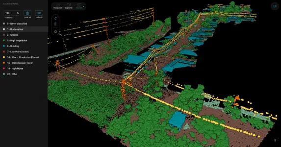
Pointly offers efficient point cloud object classification using innovative AI techniques.
Standard classifiers, based on deep learning, automatically categorize point clouds for common use cases like Airborne Laser Scans, City Inventories, and Highway Scans.
Custom classifiers provide tailored solutions for unique data requirements, ensuring accurate classification.
DF LAT is LiDAR Analysis Tool of UAV data, for obtaining high quality ground point and DTM/DSM
Please complete your Company Profile details to request a quote.