- Subscription Plans
- Favorite
- Help
-
 English
-
English
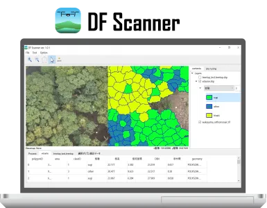
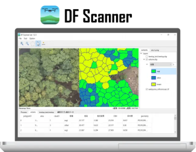
DF Scanner is GIS software for analyzing forest information from UAV, and can identify tree species and estimate tree size at each tree level.
DF Scanner is a desktop GIS software for analyzing forest information from UAV. DF Scanner need input data of orthophoto and Canopy Height Model (or DSM and DTM) with a few cm resolution. From the input data, DF Scanner can detect tree tops, segment tree crowns, identify tree speicies using deep learning, and estimate tree height and diameter at breast height. User can also train and make species identification model and identify local species. This software can be used for free for two weeks as a trial. https://deepforestlicense.com/
DeepForest Technologies Co., Ltd.
Software
DF Scanner, DF LAT
Software Solutions
Forestry & Agriculture
Japan
Japan, Belgium, Finland, France, Germany, Netherlands, Norway, Sweden, Switzerland, United Kingdom, Canada, United States
DeepForest develops software to analyze tree species and sizes at each tree level using data obtained from drones in the sky


