Data Analytics

Clear All
Search with

Filter by

Business Type

Country

Drone Class

Data Output

Photo Forward Overlap

Photo Sideward Overlap

Supporting Drone Hardware

Payload Sensor Settings

...
  • PicStork AeroMegh

    PicStork AeroMegh

    AeroMegh

    Image ProcessingObject DetectionMachine Learning
    View Product

    PicStork AeroMegh

    AeroMegh

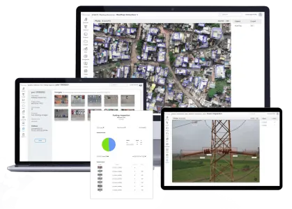
    PicStork helps automate end-to-end aerial image analytics right from capturing images to processing the data. Users of PicStork can bring their data, train detectors and analyze data, everything on their own.

  • DF Scanner

    DF Scanner

    DeepForest Technologies

    UAVDeepForestforest
    View Product

    DF Scanner

    DeepForest Technologies

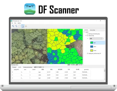
    DF Scanner is GIS software for analyzing forest information from UAV, and can identify tree species and estimate tree size at each tree level.

  • Vectorisation of 3D Pointclouds

    Vectorisation of 3D Pointclouds

    Pointly GmbH

    3D PointcloudsVector Models CAD DataSaaS Platform
    View Product

    Vectorisation of 3D Pointclouds

    Pointly GmbH

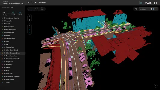
    You now have access to a comprehensive toolbox for drawing vector models in your point clouds. Easily vectorise your point clouds within Pointly’s intuitive web interface, enabling a seamless workflow and increasing the precision and efficiency of your projects.

    Make use of our intuitive toolbox to:

    - Place Points

    - Draw Polylines

    - Create Polygons