Drone Route Planning: A Complete Guide for Safe and Efficient Flights
Published by:Beyond Sky
 English
Behind every successful drone mission lies one crucial factor: route planning.
Drone route planning ensures that each flight is not just safe and compliant, but also optimized for efficiency, accuracy, and data quality. With modern drone route planning software, operators can automate complex missions, execute Beyond Visual Line of Sight (BVLOS) operations, and capture precise data while minimizing risks.
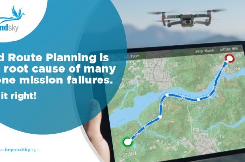
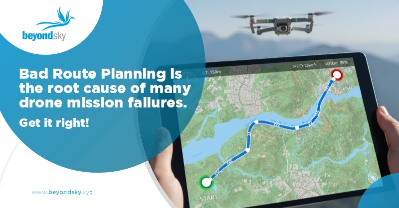
Drone route planning is the process of designing and programming a predefined path for a UAV to follow during its mission. Using specialized drone mapping software, operators set waypoints, define altitudes, specify camera triggers, and integrate real-time environmental and airspace data, all before takeoff.
This proactive approach removes guesswork, improves mission safety, and ensures compliance with aviation rules. For advanced applications like BVLOS drone planning, precision route planning is non-negotiable. It ensures drones stay connected, avoid obstacles, and maintain mission accuracy even in complex environments.
Thoughtful and data-driven route planning directly influences mission success. Here’s how it adds value:
Anticipating potential hazards such as power lines, terrain variations, or restricted zones helps avoid mid-air incidents. Geofencing and obstacle detection built into planning software keep flights safe and compliant.
Modern drone flight planning tools integrate live airspace data and NOTAM updates, ensuring missions respect local aviation laws and dynamic restrictions.
Accurate data capture relies on consistent flight paths, overlap, and triggering intervals. Planned missions ensure every image or LiDAR scan aligns perfectly for precise stitching and analysis.
An optimized route reduces battery waste, flight time, and redundant passes. With automation, teams can execute multiple missions per day across larger areas.
BVLOS drone planning software allows operators to manage long-range flights beyond line of sight, using redundant communication links, live telemetry, and safety protocols.
Modern route planning tools combine automation, safety, and precision. Let’s explore some of the most trusted options:
Each of these drone mapping software options supports data-driven workflows, offering terrain analysis, live weather overlays, and airspace updates. For BVLOS operations, select platforms with robust telemetry, dual-link systems, and automated safety responses.
Route planning has become an industry-standard requirement across sectors. Here’s how different fields are using it:
Experienced UAV operators follow proven strategies for safer, smarter flights:
Beyond Visual Line of Sight (BVLOS) operations represent the next frontier in UAV missions. By combining route planning, real-time telemetry, and advanced UAS technology, operators can manage flights spanning miles, covering linear assets, or reaching remote areas.
Modern BVLOS platforms offer features like:
As regulations evolve, BVLOS-ready planning tools are becoming central to enterprise drone programs, expanding the boundaries of what’s operationally possible.
Now available on BeyondSky, Stratomaps Route Planning calculates the shortest and safest BVLOS routes for drones, UAVs, and eVTOLs. It factors in terrain, buildings, airspace restrictions, and temporary flight limits, helping operators meet SORA requirements and fly with confidence.
The Routing API supports integration with your backend and accepts key parameters such as speed, altitude range, waypoints, and contingency buffers. It’s ideal for U-Space and UTM providers, drone developers, and fleet operators who need accurate, risk-aware routing.
Founded by Yvan Montalieu, Stratomaps specializes in aerial mapping and geospatial intelligence, offering APIs for Altitude Helpers, Route Optimization, Geo-Awareness, Terrain Following and Route Validation.
By offering Stratomaps through BeyondSky, operators can plan compliant, efficient, and low-risk BVLOS missions, fully aligned with modern drone operations.
Drone route planning isn’t just a pre-flight task it’s the foundation of modern UAV operations. With the right mix of drone mapping software, BVLOS planning tools, and operational discipline, organizations can unlock new levels of accuracy, safety, and scalability.
Whether you’re surveying a construction site, inspecting a powerline, or mapping coastal erosion, smart route planning ensures your drone flies with purpose—and lands with valuable insights.
Drone route planning is the process of designing a predefined, optimized flight path for a UAV using mapping software. It is crucial because it improves flight safety, ensures regulatory compliance, boosts data accuracy, and maximizes operational efficiency for any drone mission.
Modern route planning tools allow operators to automate missions, avoid hazards, manage battery usage, and ensure all flights comply with up-to-date airspace regulations. Features like live airspace data, weather overlays, and contingency protocols save time while improving safety and mission outcomes.
Start by defining mission objectives, choose the right altitude for your task, set appropriate image overlaps and camera triggers, manage battery life, and identify emergency landing zones. Simulate the route before takeoff to minimize errors and gaps, especially for BVLOS operations.
Top platforms include UgCS, DroneDeploy, DJI Pilot 2, Pix4D Capture & Mapper, Agisoft Metashape, QGIS, and WebODM. These tools excel in automating flight paths, supporting BVLOS, integrating real-time data feeds, and offering robust compliance features for professional workflows.
Route planning drives efficiency and data quality in sectors like surveying, construction, agriculture, utilities inspection, environmental monitoring, emergency response, and drone delivery. It ensures complete coverage, accurate mapping, and safe operations in diverse and demanding environments.
Operators should define clear mission goals, review current airspace and weather, leverage automation in advanced planning tools, set optimal imaging parameters, run virtual simulations, implement contingency plans, and analyze post-flight data for continuous improvement.
BVLOS (Beyond Visual Line of Sight) operations allow UAVs to fly longer distances without direct pilot oversight. Specialized planning software enables route optimization, redundant communications, AI-based obstacle avoidance, and automated fail-safes, making BVLOS safe, scalable, and regulation-ready.