UAV/Drone Cameras for Commercial, Industrial, and Military Applications
Published by:Beyond Sky

 English
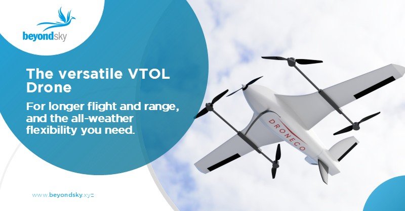
Drone cameras are the core of today’s UAVs. They turn flying frames into powerful data tools for industries, research, and defense. These are not simple cameras mounted on drones; they are specialized sensors designed to capture, measure, and interpret what the human eye cannot.
When people think of drones, they often picture spinning propellers or sleek designs. But the real purpose lies in what they see. A drone without a camera is just a moving object. Add a camera, and it becomes an instrument for observation, mapping, or measurement.
Drone cameras help farmers track crop health, energy firms inspect assets, and militaries monitor terrain. They collect visual and spectral information that drives analysis, planning, and maintenance.
Recent advances in sensor design, resolution, and payload integration have made these cameras smaller, sharper, and more efficient. They now detect heat signatures, map 3D surfaces, and capture fine details in conditions that used to block visibility.
These capture detailed images and video. A 20 MP or higher sensor paired with 4K or 5K recording allows close inspection without distortion. The DJI Mavic 3 Pro, for instance, offers clear imaging for mapping, inspection, and filmmaking. Industrial versions include optical zoom and global shutter sensors to eliminate rolling effects during motion capture.
Thermal cameras detect heat differences. Fire departments locate hotspots, while utility companies scan transformers and lines for faults. They use compact sensors that fit medium drones without affecting balance. Dual-sensor payloads often combine thermal and RGB views, giving side-by-side visual and temperature data in one frame.
Multispectral and Hyperspectral Cameras detect reflected light beyond visible ranges, including infrared. In agriculture, they help measure crop health, water stress, and soil variation. They also support environmental monitoring and resource management. Hyperspectral systems can capture over 100 spectral bands, giving a full reflectance profile of surfaces for scientific analysis.
RGB cameras record red, green, and blue light. They are used in real estate, general surveillance, and aerial photography. While basic, modern RGB systems still deliver sharp, color-accurate data. Some newer models now include global positioning metadata, enabling easy georeferencing for photogrammetry applications.
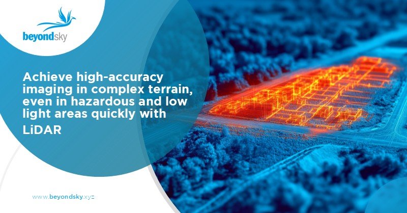
LiDAR and depth-sensing modules pair with cameras to create accurate 3D terrain models. Surveying, mining, and civil engineering rely on these to understand structure and elevation changes. LiDAR scanners, when integrated with high-resolution cameras, provide centimeter-level mapping accuracy.
Drone cameras now sit at the center of multiple industries.
In addition, drones equipped with LiDAR and high-end RGB sensors are now standard tools for land surveying and pipeline inspection. Their ability to collect dense, repeatable datasets allows for digital twins and predictive maintenance modeling.
In energy, construction, and infrastructure, visual access matters more than ever. Drone cameras deliver it without risk.
High-resolution and thermal systems are also being combined in smart inspection workflows. Software can now flag anomalies automatically by comparing current footage with baseline models, creating a data-driven approach to maintenance.
Defense applications push drone camera design further than any commercial use.
Modern reconnaissance drones often use stabilized turrets that house multiple sensors, offering simultaneous visual, infrared, and laser ranging data. This combination supports surveillance, targeting, and post-mission assessment under a single system architecture.
When selecting a camera, consider the mission before the specs.
|
Factor |
Why It Matters |
|
Resolution |
Determines clarity for inspection or mapping tasks. |
|
Stabilization |
Reduces motion blur through mechanical gimbals or digital correction. |
|
Sensor Type |
RGB, thermal, or multispectral depends on purpose. |
|
Weight |
Affects flight duration and stability. |
|
Data Interface |
Decide between onboard storage, live streaming, or both. |
|
Durability |
Essential for harsh environments or military-grade operations. |
The right balance between performance and weight often decides endurance and accuracy in real missions. Some drone systems now feature modular payload mounts, allowing quick swaps between camera types depending on the task.
Drone imaging is advancing fast. Here’s where it’s heading:
Drone cameras shape how industries and defense systems view the world. They turn raw flight into purpose-driven observation. Whether capturing fine details of a bridge or scanning thousands of acres of farmland, they deliver insight at scale.
Selecting the right setup means understanding mission requirements, operational environments, and data objectives. The right camera enhances safety, efficiency, and decision-making, turning each flight into a measurable return on investment.
Explore advanced drone cameras and accessories on BeyondSky, the global B2B marketplace for UAV technology and solutions.
The main types include high-resolution RGB cameras for general imaging, thermal cameras for heat detection, multispectral/hyperspectral cameras for agriculture, and LiDAR/depth-sensing modules for detailed mapping and 3D modeling.
Sensor quality determines clarity, accuracy, and versatility. High-resolution or specialized sensors allow drones to deliver precise inspection, mapping, or surveillance results—critical for commercial, agricultural, and defense missions.
Drone cameras provide real-time data for asset inspection, progress monitoring, and predictive maintenance. Visual analytics, paired with mapping and geotagging, help streamline planning and reduce costs in energy, construction, and agriculture.
Important features include resolution, stabilization (gimbal or digital), sensor type (RGB, thermal, multispectral), weight, data interface (live stream or onboard storage), durability, and modular design for quick payload swapping.
Advances include smarter, lighter sensors; seamless AI/data integration; extended battery life; improved low-light and weather handling; and open-platform compatibility for plug-and-play deployment across UAVs and industry software.