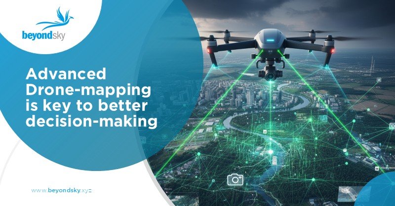
Introduction
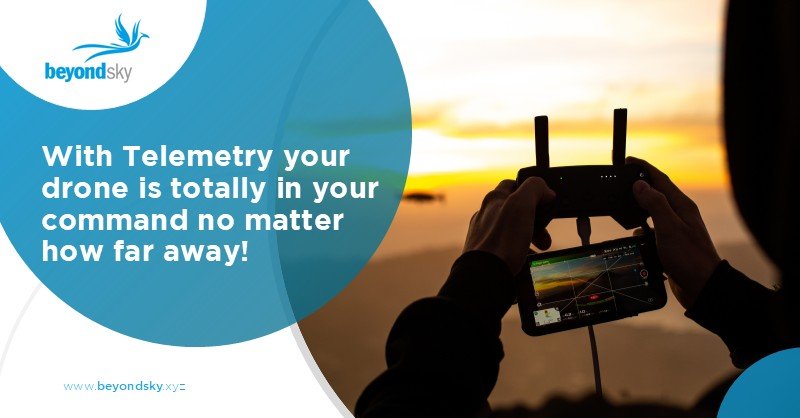
Operating drones and other unmanned vehicles also involves keeping track of their where/what/how at all times. Telemetry systems make this possible by sending back important information like location, speed, battery status, and sensor data. This data lets operators stay in control and make better decisions throughout the mission.
Without telemetry, pilots are basically flying blind. That’s why understanding telemetry systems for drones, UAVs, USVs, and UGVs is crucial.
What Is Telemetry?
Telemetry is the process of sending data from a remote device to a control station. For drones and unmanned vehicles, it is a constant stream of data coming from onboard sensors that tells operators critical details about the vehicle’s status.
For example, you get updates about the drone’s position, direction, battery, and even alerts if anything goes wrong. This keeps drone operations safe and efficient.
Why Telemetry Is Important
Imagine flying a drone without knowing its battery level or if it is drifting off course. Telemetry solves this problem by providing a real-time flow of information. Operators can react if batteries run low or if something unexpected happens.
This is even more important when controlling drones far away or out of sight since you cannot rely on visual cues. Telemetry ensures you have an accurate picture, no matter what the range.
Main Parts of a Telemetry System
- Telemetry Radio: Sends data from the vehicle to the base and sometimes back.
- Ground Receiver: Receives the data and shows it to the operator on a screen or app.
- Sensors: Track GPS location, altitude, battery levels, speed, and more.
- Control Software: Displays data clearly and may allow sending commands back.
Every link in this chain needs to work well for smooth operations.
Finding the Best Telemetry System
Choosing the right telemetry depends on the vehicle type and mission.
- Drones and UAVs use lightweight radios on frequencies like 900 MHz or 2.4 GHz. These offer good range and keep power use low.
- USVs on water use radios plus cellular or satellite communication for longer coverage.
- UGVs face obstacles like hills or buildings that block signals. Mesh networks or other technologies help them stay connected.
Picking a system means balancing range, data speed, power draw, and signal reliability.
Uses of Telemetry Data
Telemetry data is more than numbers. It helps operators:
- Stamp out navigation errors by showing exact position and heading.
- Monitor battery and motor health to avoid surprise failures.
- Control onboard instruments such as cameras or sensors.
- Record mission logs for safety audits or later review.
This data turns flying or driving into a manageable task rather than guesswork.
Technology Advances
- Telemetry radios have improved with standard protocols like MAVLink. These make sure different drones and software can talk to each other cleanly.
- Some radios use techniques like frequency hopping to avoid interference and encrypt data for security.
- Cellular and satellite links extend how far drones can operate by providing broader coverage beyond radio range.
Challenges to Overcome
- Telemetry is powerful, but not perfect. Signal loss happens, especially in urban canyons or forests.
- High data volumes from cameras or sensors strain the system and reduce flight times due to power consumption.
- Regulations limit signal strength and frequencies you can use, so setups must follow local rules.
What’s Next?
Expect to see:
- Telemetry systems that handle more data at once, including 4K video or high-res sensor info.
- More drones using cellular and satellite telemetry for global reach.
- AI tools that analyze telemetry data live for predictive warnings.
- Easier ways to link telemetry with other systems and vehicles in a mission.
Telemetry is becoming smarter and more flexible to keep up with complex drone missions.
How BeyondSky Helps You Source Advanced Telemetry Systems
As unmanned systems become more autonomous and data-driven, choosing the right telemetry system is essential for mission reliability, real-time situational awareness, and safety. Whether you're operating drones (UAVs), unmanned surface vessels (USVs), or unmanned ground vehicles (UGVs), the quality of your telemetry solution directly impacts communication range, control accuracy, and operational efficiency.
BeyondSky, the world’s first B2B marketplace for the global drone industry, simplifies how organizations discover, compare, and procure trusted telemetry hardware and software solutions.
Conclusion
If you want to operate drones, USVs, or UGVs well, a solid telemetry system is a must. It’s the means of seeing what your craft is doing, staying safe, and flying with confidence.
Choosing the right telemetry depends on what you build and where you fly. Knowing the basics helps you pick gear that fits your mission and keeps critical info flowing clearly.
Telemetry is what brings unmanned vehicles to life in ways a human pilot alone cannot.
FAQs
- What is telemetry in drones?
Telemetry is the real-time transmission of data from a drone or unmanned vehicle to its operator, including position, battery status, speed, sensor readings, andsystem health.
- What are the main components of a drone telemetry system?
Key parts include telemetry radios, ground receivers, onboard sensors (GPS, battery, speed, etc.), and control software that displays data and can send commands back.
- How do telemetry systems differacrossdrones, USVs, and UGVs?
Drones use lightweight radios on 900 MHz or 2.4 GHz bands. USVs often combine radios with cellular or satellite links for broader range. UGVs rely on mesh networks or other tech to maintain connectivity over obstacles.
- Why is telemetry essential for drone operation?
Telemetry ensures operators have continuous,accurate data to monitor flight status, avoid navigation errors, manage battery health, and operate sensors safely even beyond line of sight.
- What challenges affect telemetry performance?
Signal loss in urban canyons or forests, high data volumes draining batteries, and legal restrictions on frequencies or power can limit telemetry reliability.
- How is telemetry evolving in drone technology?
Advances include standardized protocols likeMAVLink, frequency hopping for interference resistance, encrypted data transmission, and growing use of cellular/satellite links for global coverage.
- What future trends are expected for drone telemetry?
Telemetry will handle richer data streams like 4K video, use AI for predictive insights, integrate with multiple vehicle types in a mission, and improve user interfaces for seamless control.


 English