- Subscription Plans
- Favorite
- Help
-
 English
-
English

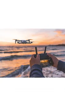
Design Drone Lab, is a certified drone operator. We believe that drones have the potential to transform a wide range of industries, and we are dedicated to helping others discover the many benefits of this technology. We provide services - GIS Consultation, Data Acqusitions, Data Treatment & Reprting, Softwares, Business Development, Training/Recommendation etc. We majorly focus on educational institutes, farmers & various industries.
Design Drone Lab, is a certified drone operator. We believe that drones have the potential to transform a wide range of industries, and we are dedicated to helping others discover the many benefits of this technology. We provide services - GIS Consultation, Data Acqusitions, Data Treatment & Reprting, Softwares, Business Development, Training/Recommendation etc. We majorly focus on educational institutes, farmers & various industries.
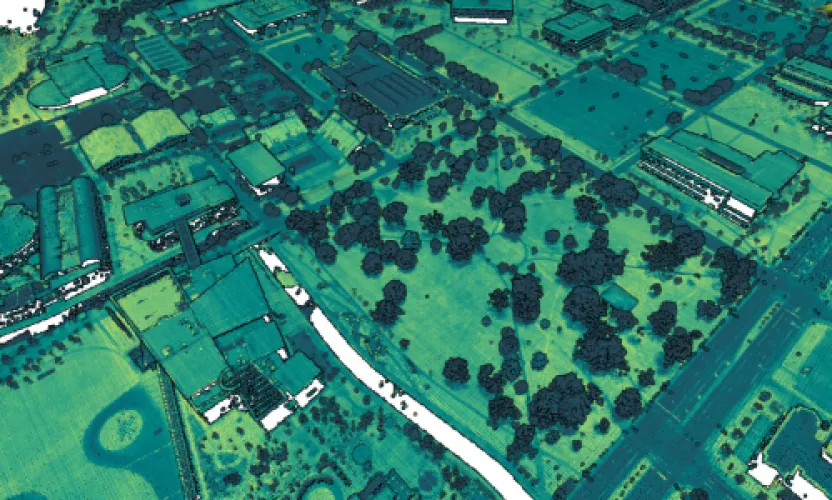
- Create Digital elevation model
- NDVI map (Normalized difference vegetation index)
- Topographic map
- DTM, DSM
- Ortho image for urban and rural area - for decision makers, city planners
- Drought, Soil Moisture Monitoring

Drone Design Lab
Education
Drone Mapping Software solutions, Drone education for schools groups, businesses, Drone consultancy/advisory for 1:1, for groups, for companies.
Consultancy
Aerial Photography, Construction & Real Estate, Education, Environment & Wildlife, Forestry & Agriculture, Leisure & Hobby, Others, Surveillance & Mapping
Poland
American Samoa, Australia, Bouvet Island, Brunei Darussalam, Cambodia, China, Christmas Island, Cocos (Keeling) Islands, Cook Islands, East Timor, Fiji, French Polynesia, Guam, Hong Kong, Indonesia, Japan, Kiribati, Lao, Malaysia, Marshall Islands, Micronesia, Federated States of, Mongolia, Myanmar, Nauru, New Caledonia, New Zealand, Niue, Norfolk Island, North Korea, Northern Mariana Islands, Palau, Papua New Guinea, Philippines, Pitcairn, Samoa, Singapore, Solomon Islands, South Korea, Taiwan, Thailand, Tokelau, Tonga, Tuvalu, Vanuatu, Vietnam, Wallis and Futuna Islands, Albania, Andorra, Armenia, Austria, Azerbaijan, Belarus, Belgium, Bosnia and Herzegovina, Bulgaria, Croatia (Hrvatska), Cyprus, Czech Republic, Denmark, Estonia, Faroe Islands, Finland, France, French Southern Territories, Georgia, Germany, Gibraltar, Greece, Greenland, Guernsey, Hungary, Iceland, Ireland, Isle of Man, Italy, Jersey, Kazakhstan, Kosovo, Kyrgyzstan, Latvia, Liechtenstein, Lithuania, Luxembourg, Monaco, Montenegro, Netherlands, Norway, Poland, Portugal, Romania, San Marino, Serbia, Slovakia, Slovenia, Spain, Svalbard and Jan Mayen Islands, Sweden, Switzerland, Tajikistan, Turkey, Turkmenistan, Ukraine, United Kingdom, Uzbekistan, Vatican City State, Latin America & Caribbean, Middle East & North Africa, North America, South Asia, Angola, Benin, Botswana, Burkina Faso, Burundi, Cameroon, Central African Republic, Chad, Comoros, Congo, Equatorial Guinea, Eritrea, Ethiopia, Gabon, Gambia, Ghana, Guinea, Guinea-Bissau, Ivory Coast, Kenya, Lesotho, Liberia, Madagascar, Malawi, Mali, Mauritania, Mauritius, Mayotte, Mozambique, Namibia, Niger, Nigeria, Reunion, Rwanda, Sao Tome and Principe, Senegal, Seychelles, Sierra Leone, Somalia, South Africa, St. Helena, Sudan, Tanzania, Togo, Uganda, Zambia, Zimbabwe
We are a female-led geospatial startup, offering drone educational workshops to the public and empowering women in the industry. We aim to close the gender gap in the drone industry by introducing drones to classrooms and businesses. Drones for the next generation of digital education. GIS/Remote sensing solutions for companies. Our team is pleased to be available to connect and provide support on rural and urban development issues for the impact of sustainable development goals.